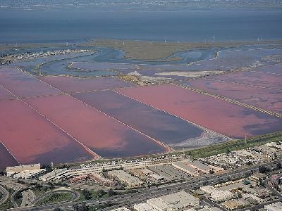
Salt ponds view from Coyote Hills, photo by Wikimedia user Dllu CC BY-SA 4.0
Coyote Hills Regional Park
Local History • Views • Nature
Salty breeze over a beautiful bay
The South Bay gets a bit overshadowed by the dramatic vistas of the North and East Bays, but she sure can hold her own with the outdoor scenes! If you’ve had the window seat on a flight out of SFO, you’ve likely seen the patchwork of multicolored pools in the southern part of our beloved Bay. Did you know those are man-made salt ponds? The ponds are engineered to extract and harvest salt from the salinity of the Bay water, and the 8,000 acres of ponds are currently managed by the Cargill corporation.
There are all kinds of trails, marshes, and hills to explore in the nearly 978 acres of Coyote Hills, not to mention views of all three area bridges.
Adventure Info
Nearby Food
While you’re in the area, grab food from these Black-owned food establishments:
